Juaning slows down, rapidly gains strength

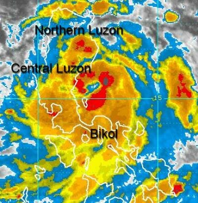
NAGA CITY (July 27, 2011 8:00 A.M.) - Tropical Storm Juaning(International name: Nock-ten) has rapidly gained strength as it approaches the coast of Aurora.
Juaning has now a sustained center wind of 100 kilometers per hour (kph) with gusts up to 130 kph. With a diameter of 555 kilometers, Juaning's rainbands cover the whole of Luzon including Northern Bicol.
The storm now moves West Nothwest at 13 kph towards the general direction of Aurora-Northern Luzon.
At 6:00 A.M. today, the center of Juaning was located 80 kilometers Southeast of Baler, Aurora or 85 kilometers Northeast of Infanta, Quezon at coordinates 15.4º North Latitude 122.2º East Longitude.
Juaning will make landfall over or near Baler this morning between 9 A.M. to -10 A.M. about 70 kilometers Southwest of Casiguran, Aurora. It is expected to continue moving West Northwestward across Luzon and into the West Philippine Sea (South China Sea) within the next 1-2 days. It shall weaken slightly upon traversing the northern part of Central Luzon and re-intensify upon emerging over the West Philippine Sea.
This afternoon, Juaning shall be in the vicinity of Nueva Ecija-Nueva Vizcaya Border and weakens slightly after crossing the Sierra Madre Mountains about 40 km SE of Baguio City . This system is expected to cross Northern Pangasinan-Southern Benguet-La Union before moving out into the West Philippine Sea late this afternoon. It will pass very close to the south of the cities of Baguio and San Fernando between 4PM to 6PM today.